Buenos Aires, Charles Darwin, and the Giant Ground Sloths

Darwin's giant ground sloth
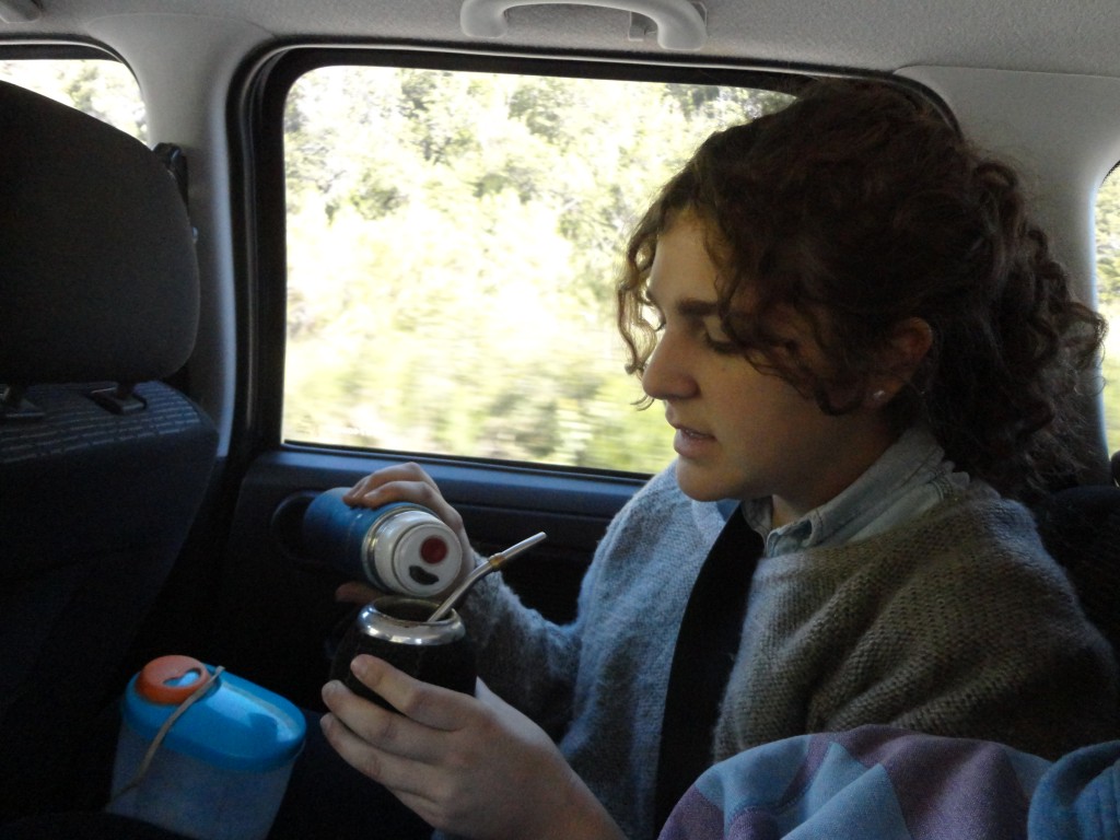
I’m currently working on a travel memoir of a recent trip to Patagonia. Our first stop was Buenos Aires, where we toured the opera house, visited the cemetery (trust me, it’s the thing to do), and dreamed about Darwin and the giant ground sloths.

Giant ground sloths, you say?

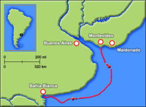
As a scientist and historian I couldn’t help but think of Darwin as we wandered around the capital city of Argentina. I had hoped to get further south to the Mar del Plata Aquarium but weather and circumstances conspired to disappoint me. I took consolation in the knowledge that Charles Darwin, of Origin of Species fame, spent many months in the coastal areas south of Buenos Aires during his five-year voyage on the HMS Beagle. After general wanderings around Rio de la Plata, the estuary of which separates Buenos Aires and Argentina to the south and Montevideo and Uruguay to the north, Darwin headed to Bahia Blanca and Punta Alta. It was in Punta Alta that Darwin really became enamored of his adventurous investigations, which up until now had been mostly at sea during the long Atlantic crossing, and a few forays into the interior of Brazil near Rio de Janeiro and across into Montevideo.

Darwin's giant ground slothIt was also in Punta Alta that Darwin made one of his biggest scientific discoveries. Ranging about the landscape on horseback, sleeping in the open with guachos or staying in haciendas with local ranchers, Darwin stumbled upon the fossilized bones of, well, something. One specimen was “the head of some large animal, embedded in soft rock.” He thought it might be similar to a rhinoceros. It took a second visit several months later – FitzRoy and his crews were busy mapping up and down the coastline – to realize he had discovered a large number of large mammal fossils not previously known from previous scientific expeditions to Europe, Asia, or Africa. In all he found nine different types of “great quadrupeds.”

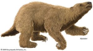
Dutifully shipping the fossils with the thousands of other samples collected to various collaborating scientists in Europe, these large mammal fossils ended up via a circuitous route in the hands of French scientist Georges Cuvier. Cuvier determined that these were the bones of what became known as giant ground sloths, some as big as elephants, which roamed widely in the ancient North and South American plains. Cuvier named the huge beast Megatherium, which is, appropriately enough, derived from the Latin for “huge beast.”

Darwin's giant ground sloth
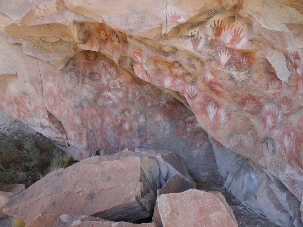
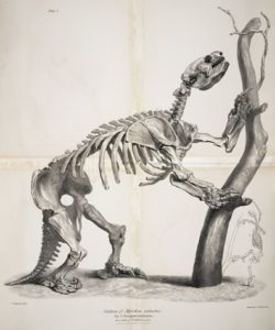
Here is where the plot thickens. While Cuvier was working up his paper describing and naming Megatherium, workers in what is now West Virginia dug up some old bones and sent them to Virginia’s biggest paleontological expert, who just happened to be Vice President of the United States, Thomas Jefferson. Jefferson named these new bones Megalonyx jeffersonii, meaning “giant claw” (the jeffersonii species name is an affectation that many discoverers take when naming their new species). These too turned out to be giant ground sloths. Meanwhile, Darwin was digging up even more sloth species. Many of these ended up in the Museo Municipal de Ciencias Naturales “Carlos Darwin,” set up in Punta Alta by modern day Argentinian geologist Teresa Manera.

Why is the museum called Carlos Darwin instead of Charles Darwin, you might ask? The museum was established in the late 1990s, not long after the Falklands War. The Falkland Islands, known in Argentina as the Malvinas Islands, were a disputed territory off the coast of Argentina. The British had claimed them many years before and engaged in a war to protect their claim when Argentina tried to get them back. Not surprisingly, the museum wasn’t too keen on recognizing the English at the time so they used the Spanish form of Charles – Carlos – instead. Teresa Manera and her husband, by the way, also discovered giant ground sloth footprints on a beach near there and has been trying for decades to get it made a UNESCO World Heritage Site.

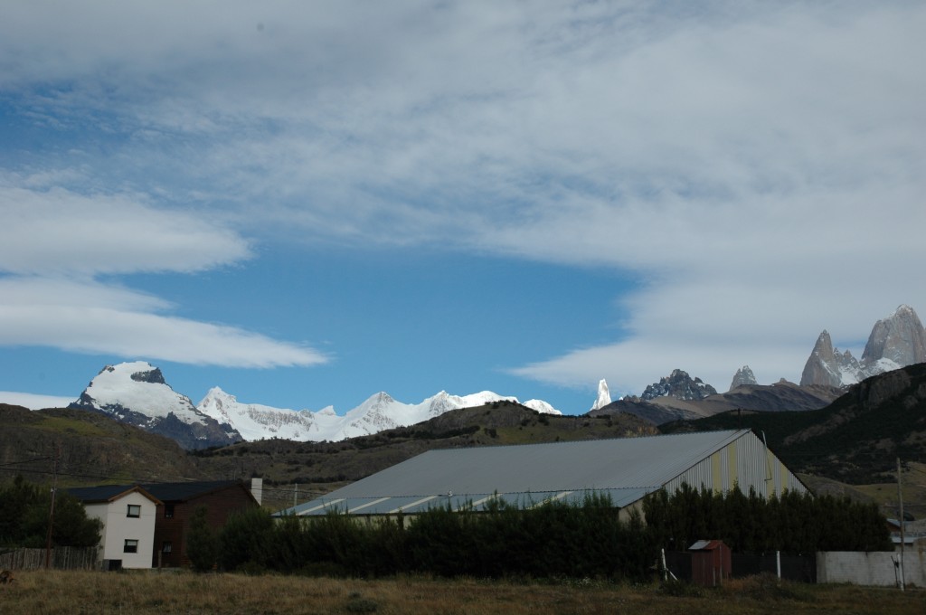
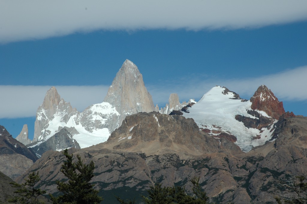
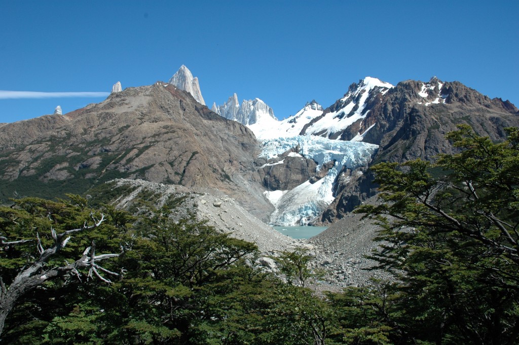
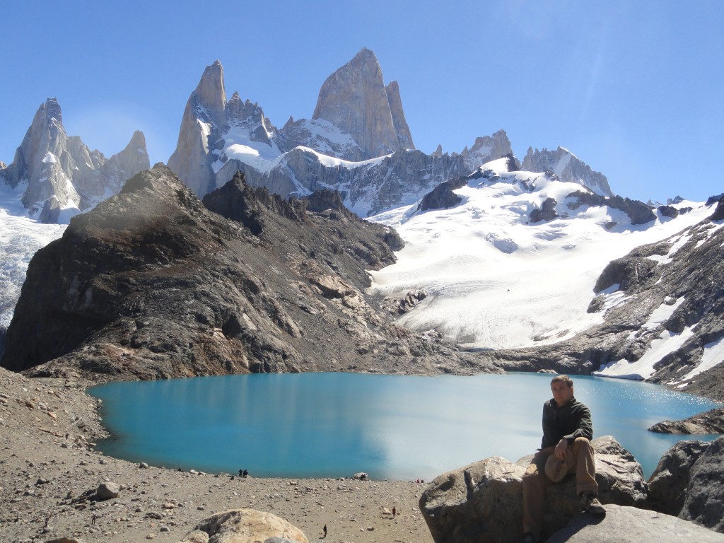
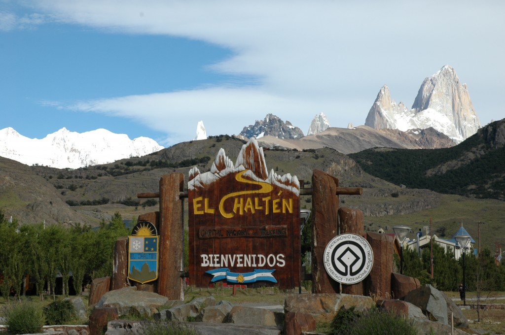
Darwin wasn’t finished in South America, of course; the Beagle gave him plenty of time to explore Patagonia, both in Argentina and Chile. My own travels in Patagonia included climbing up to the base of Cerro FitzRoy, the mountain in the lower Andes named after the Beagle‘s captain, with whom Charles Darwin spent five years living in a cabin not much bigger than a closet.

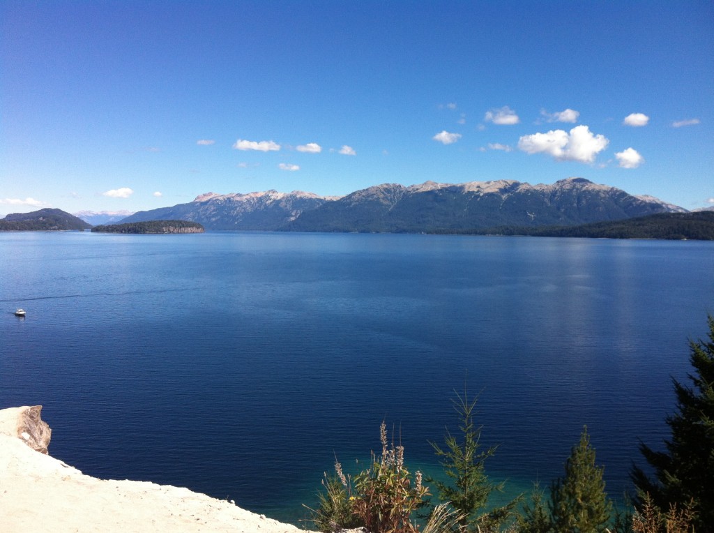
Meanwhile, our time in Buenos Aires was quickly coming to an end and we were headed out to Bariloche to start our big adventure. Darwin would make more appearances along the route.

For previous articles about Buenos Aires and Patagonia, this post is a good place to start.

David J. Kent is an avid science traveler and the author of Lincoln: The Man Who Saved America, now available. His previous books include Tesla: The Wizard of Electricity and Edison: The Inventor of the Modern World (both Fall River Press). He has also written two e-books: Nikola Tesla: Renewable Energy Ahead of Its Time and Abraham Lincoln and Nikola Tesla: Connected by Fate.

Check out my Goodreads author page. While you’re at it, “Like” my Facebook author page for more updates!

Follow me by subscribing by email on the home page. Share with your friends using the buttons below.

Preparing for Machu Picchu

Machu PicchuMachu Picchu is on my science traveling list for this year, so I’m doing some preparation and planning for the trip. That includes some background reading like the book, Turn Right at Machu Picchu: Rediscovering the Lost City One Step at a Time, by Mark Adams. I’m only about 20% into it so can’t comment about the quality of the book yet, but already it’s given me some ideas for the future…and brought back some cool memories of a past trip.

The author is retracing the footsteps of Hiram Bingham III, the Yale professor who is credited with discovering Machu Picchu in 1911. As with many great discoveries, there is some intrigue about whether he was the first or not and how much it was an accident of faith to find it, but that’s a story for another time. What Bingham was actually looking for was the “Lost City of the Incas.” Before stumbling on Machu Picchu he actually first found a place called Choquequirao.

Choquequirao is considered a sister site to Machu Picchu; to this day it remains largely uncovered and undefiled by the tourist hordes. What struck me about Choquequirao was the eerily familiar approach. Adams has a photo that looks like a lot like this:

Pinturas River valley


My photo above is the approach to the Cueva de las Manos (the Cave of the Hands) in southern Patagonia, Argentina. Those are full size trees in the valley. The caption in the Adams photo says that his valley was mine on steroids – though only six miles total it took “two grueling days” of hiking down, then up. My valley was done in a long half-day, but to me it seemed no less grueling.

Reading the book gives me a taste of what to expect on the trip, as well as some fantastic background history on Inca culture and Andean geography. But it also gave me something completely unexpected – a connection to Abraham Lincoln. It seems that joining Bingham on his expedition to Choquequirao was a “well-connected young man” by the name of Clarence Hay. If that name sounds familiar it’s because Clarence Hay is the son of John Hay, the former Secretary of State to Presidents McKinley and Roosevelt – and former personal secretary to yet another president, Abraham Lincoln.

As I continue reading the book, and continue to prepare for Machu Picchu, I also find myself wanting to write more about my previous trip to Patagonia. I’ll be doing that in the near future. Until then you can read my earlier reminiscences of Patagonia here.

David J. Kent has been a scientist for thirty-five years, is an avid science traveler, and an independent Abraham Lincoln historian. He is the author of Tesla: The Wizard of Electricity (now in its 5th printing) and two e-books: Nikola Tesla: Renewable Energy Ahead of Its Time and Abraham Lincoln and Nikola Tesla: Connected by Fate. His book on Thomas Edison is due in Barnes and Noble stores in spring 2016.

Follow me by subscribing by email on the home page.  And feel free to “Like” my Facebook author’s page and connect on LinkedIn.  Share with your friends using the buttons below.

Revisiting Patagonia

Patagonia
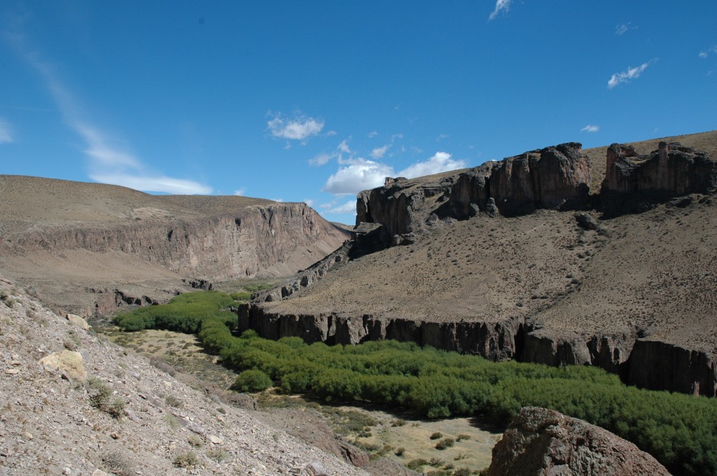
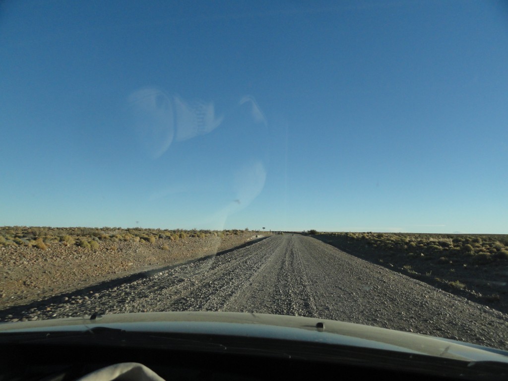
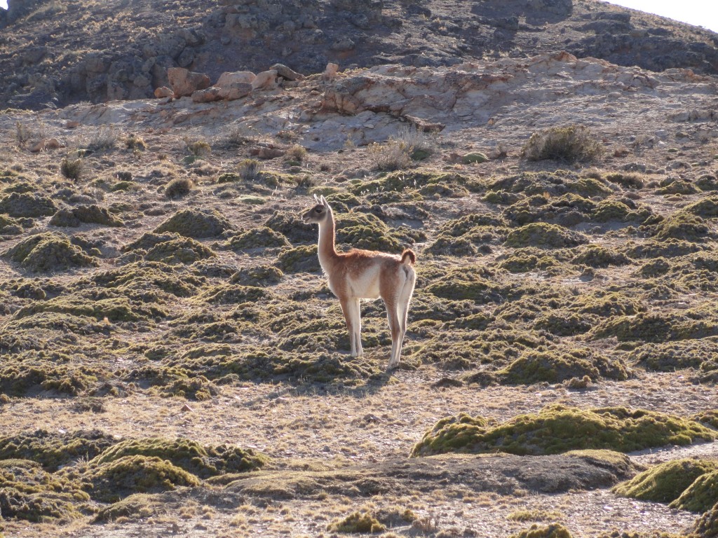
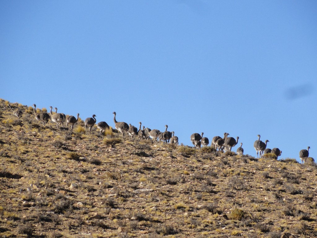
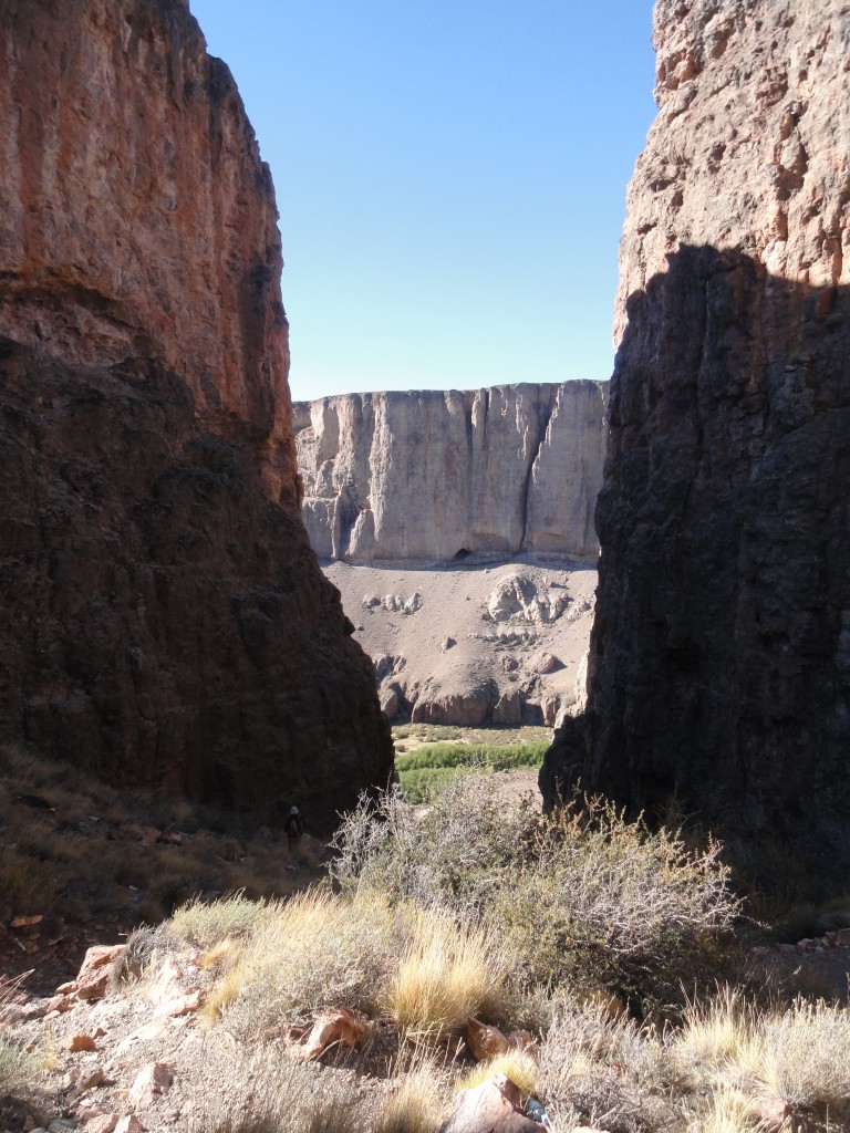
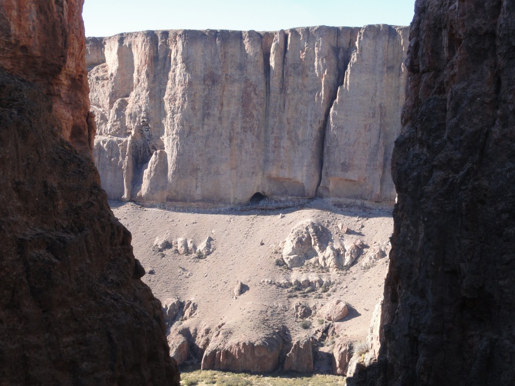
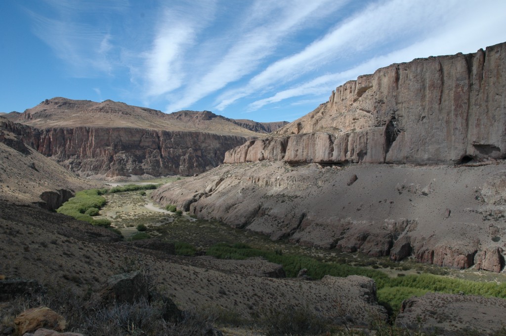
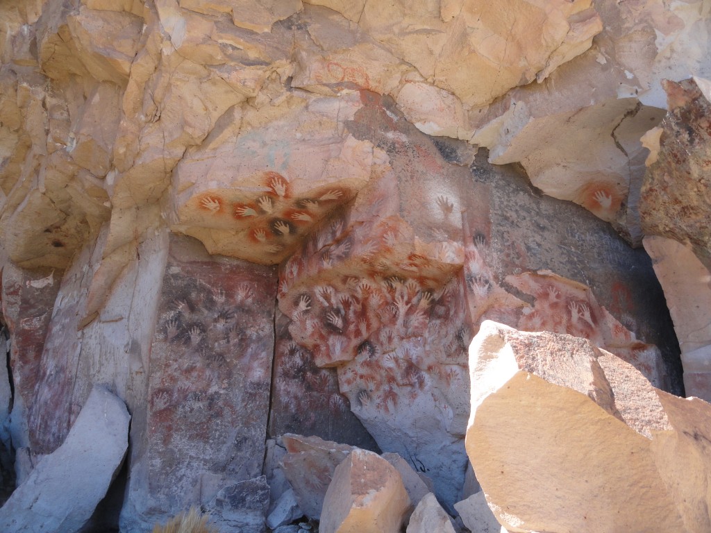
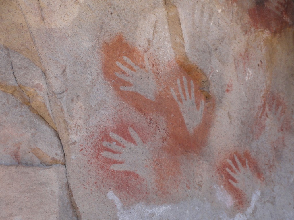
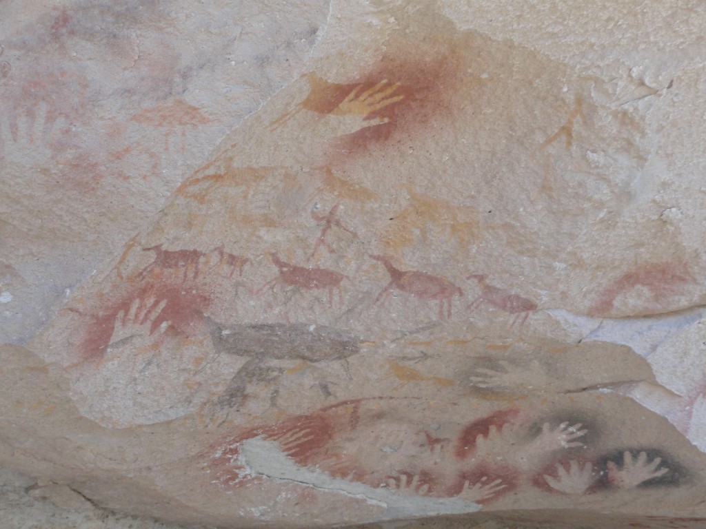
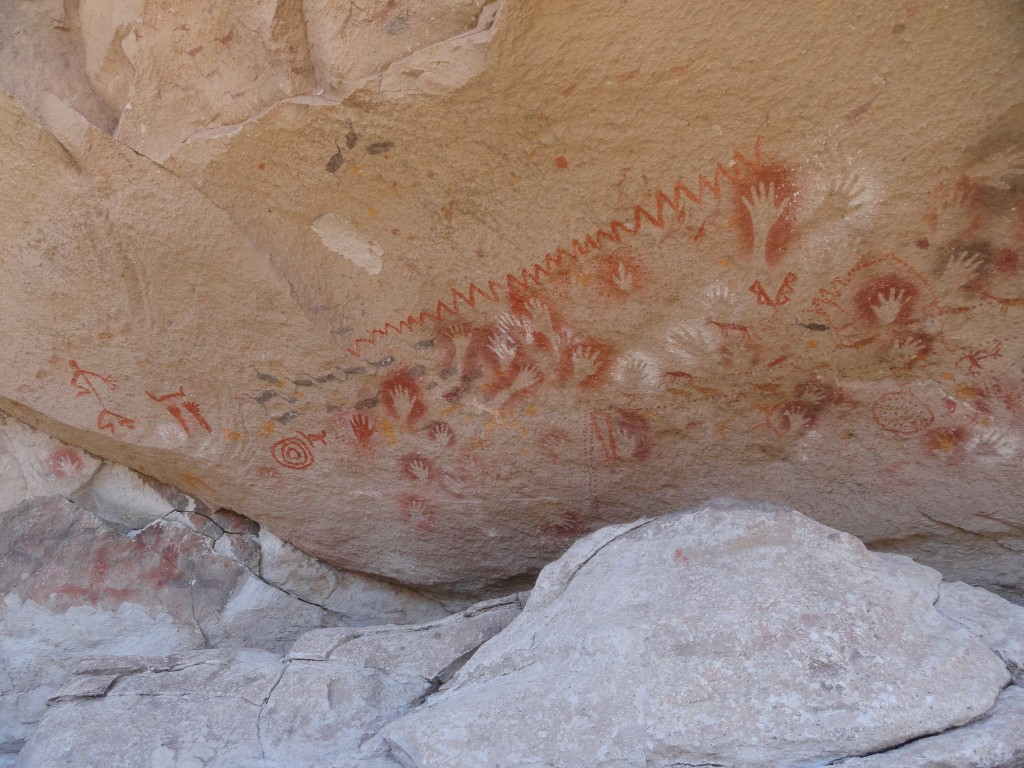
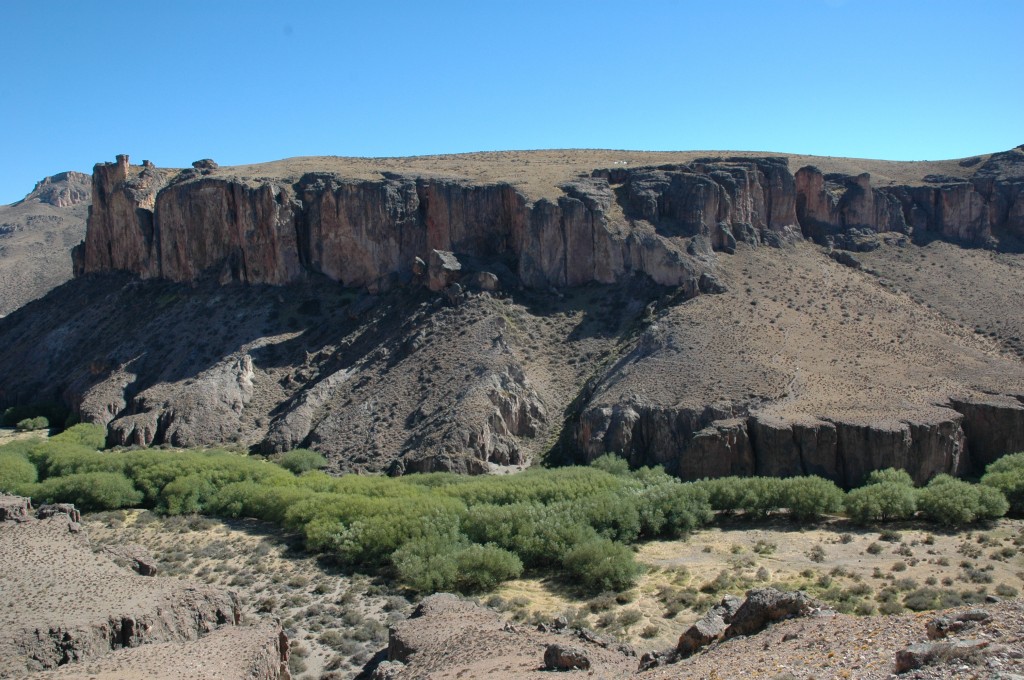
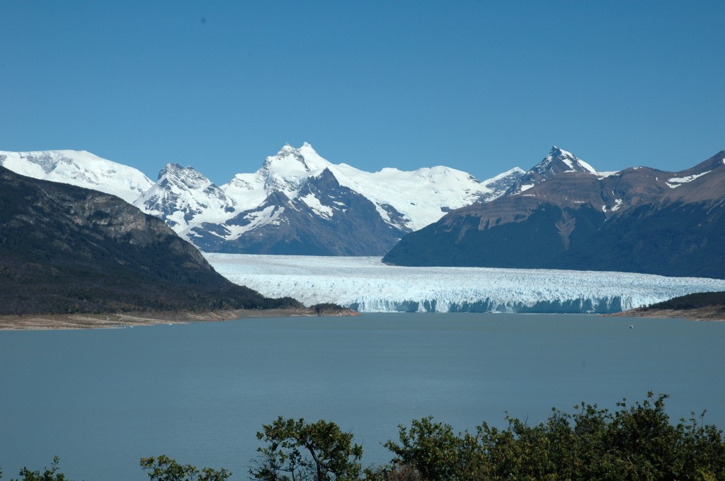
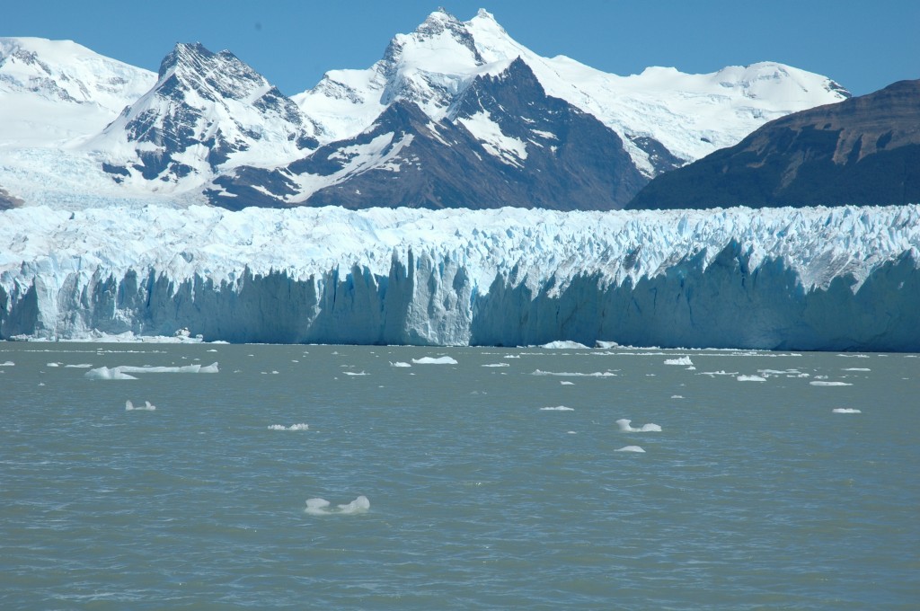
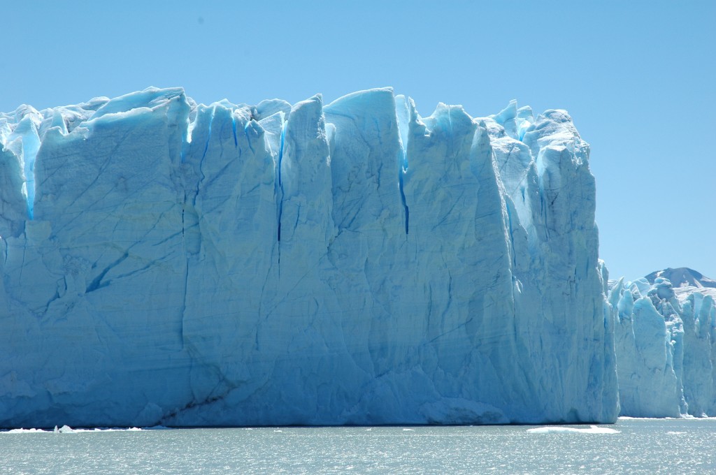
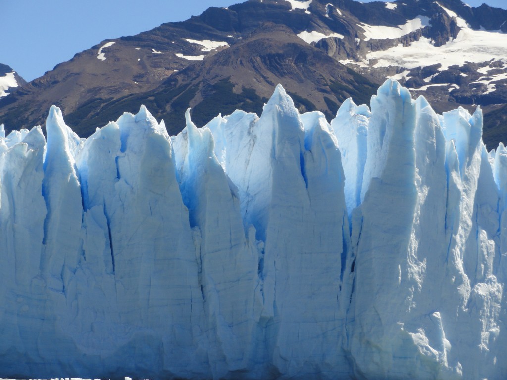
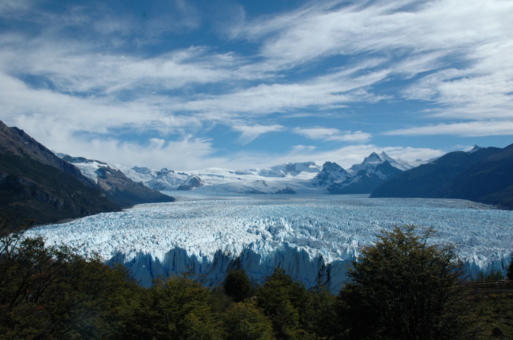
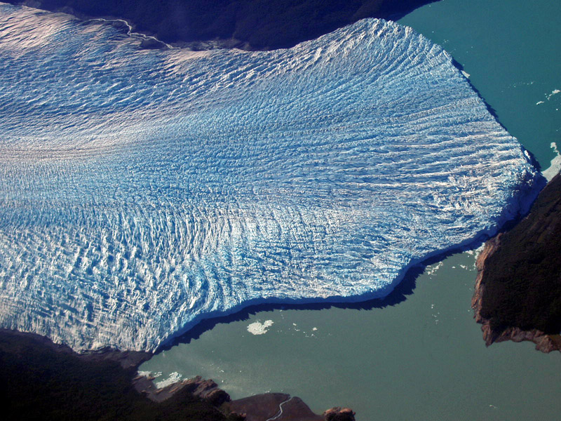
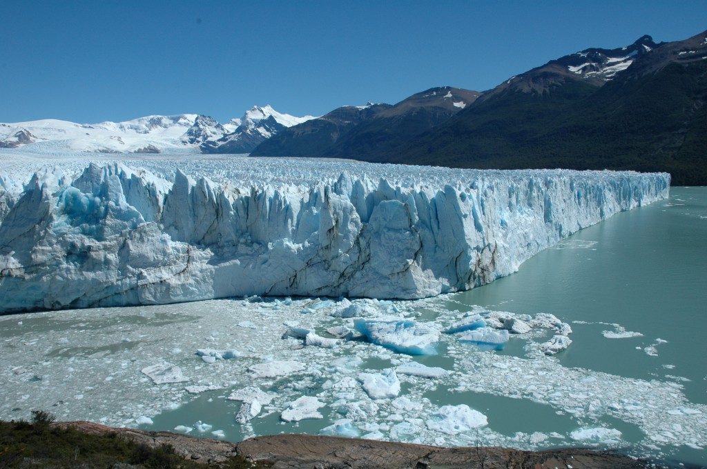
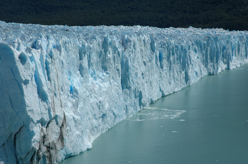
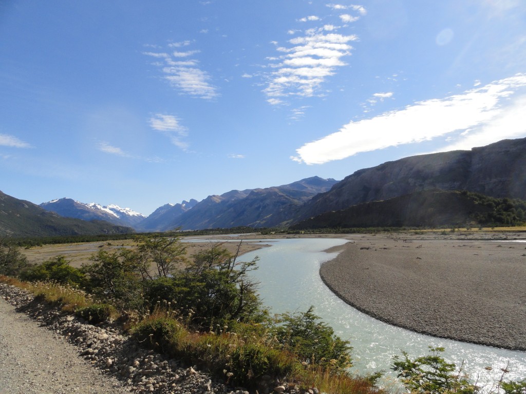
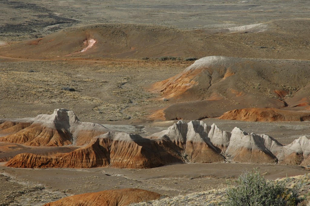
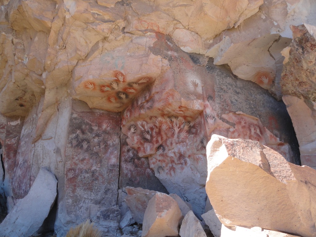
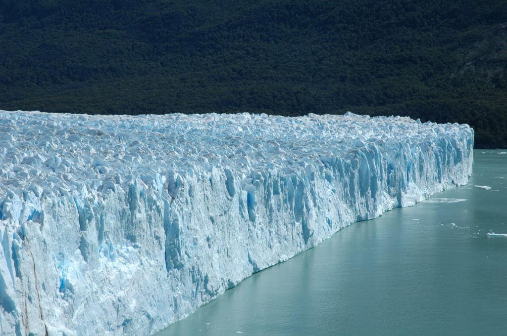
Patagonia is one of the most diverse geographies on Earth. It encompasses the lower end of South America, mostly in Argentina but also spanning Chile. As such it touches on two coastlines – the Atlantic on the Argentinian east and the Pacific on the Chilean west. The area goes from the high Andes, to the low scrubland plains, the large lake filled northwest, glaciers in the southwest, and coastlines of the southeast. Animals range from the ostrich-like choiques (CHOY-kas) and camel-like guanacos (WAN-a-coes) to snakes and penguins. Yes, penguins.

Perito Moreno glacier - front and north faces

Last year I spent three weeks in Patagonia, traveling from the very north in Bariloche down through the Argentinian side of the Andes mountains to the southern glaciers at Perito Moreno. A planned visit to the Chilean side of the Andeans was quashed by an unforeseen broken ankle (my host’s, not mine), but that opened up a return trip driving east through the desert-like steppe and up the eastern coastline. Another week was split between enjoying the beautiful lakes of Bariloche and visiting various doctors and hospitals (see “unforeseen broken ankle”). I also got to visit with my host’s fisheries biology lab mates. All in all a fantastic trip.

I’ll be writing much more on Patagonia (and planning another South American trip), but to catch everyone up here are links to previous posts. Click on the titles below.

The Route: A quick tour of the plan for the trip, and some highlights.

Cueva de las Manos…the Cave of the Hands: An amazing place with 10,000 year old hand prints. It was quite a challenge to hike to, which made it all the more incredible.

Mount Fitz Roy and the Glaciers: Mountains named after the Captain of the Beagle (Charles Darwin’s ship). An amazing hike with even more amazing views.

Up Close and Personal with the Perito Moreno Glacier: One of the most iconic glaciers in the world (you’ve probably seen photos). It’s even more impressive up close.

The Gravel Roads of Patagonia: This was a road trip. Except the roads were often more in name than actuality. A good story was had by all.

Drinking Tea, aka, Mate, in Argentina: No trip to Patagonia is possible without a healthy dose of matte, the South American “tea” that is as much a social event as it is a libation.

Much more on Argentina and other points south in the future.

David J. Kent is an avid science traveler and the author of Lincoln: The Man Who Saved America, now available. His previous books include Tesla: The Wizard of Electricity and Edison: The Inventor of the Modern World (both Fall River Press). He has also written two e-books: Nikola Tesla: Renewable Energy Ahead of Its Time and Abraham Lincoln and Nikola Tesla: Connected by Fate.

Check out my Goodreads author page. While you’re at it, “Like” my Facebook author page for more updates!

Follow me by subscribing by email on the home page. Share with your friends using the buttons below.

The Gravel Roads of Patagonia

Thump.

My leg instinctively jerks away even though this is the tenth time a rock has stung the floorboards beneath my foot. The ping strikes my ears a split second after the thump has stimulated my autonomic reaction. Thump, ping, repeat.

This is Route 40, about 250 km of dirt – no, make that gravel – that Argentina considers a highway. Gravel roads are common here in the southern reaches of Argentina, which is more than can be said for road signs. Except for signs blazing the word “Desvio;” Detour. Desvio signs are ubiquitous along this side of the Patagonian Andes. Detour. The sign itself is obvious, but the road to which you’re detouring to? Well, not so much. We’re pretty much off the grid for the next several days, with hundreds of kilometers between towns, no phone service, no internet, and as I’ve been finding out, often no road.

Gravel roads in Patagonia

This is one of the better roads

I’m traveling with my long-time friend and Argentine host, Pablo. Even he has been having difficulty following the road. Desvio signs pop up as routinely as the gravel thumps against the bottom of the car. Several times we had to stop to ask for help locating the road, something that I wouldn’t have been able to do if I was traveling alone. If you don’t speak the language, it’s definitely a plus to be traveling with a native. We actually had to stop to ask the only person we had seen for many miles – the driver of a road grader leveling the mountain of rocks into a semblance of a highway.

Compounding the difficulty was that the gravel roads aren’t captured well on maps. You’ll be driving along a beautifully paved road and suddenly, with no other visible options, another sign pops up – Fin de Pavimento (End of Pavement). I should mention that we’re talking about roads that go on for tens or hundreds of kilometers with no outlets. You’re on this road going one direction, or you’re on it going the other direction. Even then, sometimes you can’t tell which direction you’re going.

Occasionally you’ll suddenly see an opening and get to pop back up onto a partially paved section in the middle of nowhere, but usually that pleasure is short-lived and you’re quickly back on gravel. The road surface ranges from packed dirt and pebbles (a rarity) to looser pebbles (more common) to coarse gravel (even more common) to what the official Krumbein Phi Scale of particle size officially calls cobble. Way too often the road is reminiscent of salmon spawning streams with rocks the size of bricks piled high in the middle of self-made tracks. These are the loudest, and scariest, clanks on the bottom of the car.

The car, by the way, is a Ford EcoSport SUV, so we sit high above the road surface. And still the stones thump.

My foot jerks away again. It actually feels like the rock is a direct strike to the bottom of my shoe.

Gravel roads are common in Pablo’s hometown of Bariloche as well, though mostly at the better end of the spectrum between “noisy but drivable” and “should be condemned as impassible.” So prevalent are gravel roads that Pablo says everyone adds one option to their new car purchase – steel plates on the underside of the car to protect the engine compartment and the gas tanks from puncture.

Thump.

But apparently not the floor boards in the back seat area. It’s a different world down here.

[For more articles on Argentina, click here and scroll down, or simply type Argentina into the search box at the top of the page]

[This is a cross-post from my Hot White Snow site while I’m out science traveling.]

David J. Kent is the author of Tesla: The Wizard of Electricity (2013) and Edison: The Inventor of the Modern World (2016) (both Fall River Press). He has also written two e-books: Nikola Tesla: Renewable Energy Ahead of Its Time and Abraham Lincoln and Nikola Tesla: Connected by Fate. His next book is on Abraham Lincoln, due out in 2017.

Follow me by subscribing by email on the home page.  And feel free to “Like” my Facebook author’s page and connect on LinkedIn.  Share with your friends using the buttons below.


[Daily Post]

In Patagonia, Don’t Miss The Cave of the Hands…or the Camels!

Yes, I said camels. More on that in a minute. As I’ve been documenting, Ru and I joined my friend Pablo and his two daughters Juli and Mica touring, trekking, and tripping down the eastern side of the Andes mountains of Patagonia, southern Argentina. One of our stops was the Cueva de las Manos…the Cave of the Hands.

Cueva de las Manos

A UNESCO World Heritage site, the Cueva de las Manos is in such a remote location that it’s often missed by most casual tourists. Since driving all the way around to the main access road would take us over 150 kilometers out of our way, we decided to hike to it. After spending a night in a comfy log cabin, the five of us drove 17-km along a winding gravel road, along which we saw guanacos (WAN-a-coes), which look like short-haired llamas but, like the llamas, vicunas, and alpacas are actually closely related to camels.

Guanaco

We also saw choiques (CHOY-kas), which are ostrich-like birds that people up north may have heard called rheas. I’ll have more on these and other Patagonian wildlife (including condors) in a future post.

Choique (Rhea)

Eventually we arrived at the end of the road, but not the end of the trail, for where we were parked was on the opposite side of the valley from where we needed to be. So we hiked down this valley; that’s the cave peaking out from the other side.

Cueva de las Manos

And a little closer…

Cueva de las Manos

Once on the other side we could see the valley we crossed. To give you perspective, the greenery in the center are full-size trees nestled along the Pinturas River. I admit we dallied in the wonderful shade they provided from the mid-day sun as we crossed a footbridge over the river.

Pinturas River valley

By the way, our car is at the top of that ridge on the right. But let’s not think about the return trip just yet. Let’s go see the cave.

Cueva de las Manos

Okay, the cave itself is not so impressive. It’s about 10 meters high, 15 meters wide, and about 24 meters deep. It’s what is outside the cave that stirs the imagination. To get an idea of the layout, take a look at the photo below, which shows the valley and the cave system on the right wall.

Cueva de las Manos

The main cave is the hole to the right about mid-way where the slope meets the cliff. However, following along what looks like a cut as you move left in the photo traces over 4000 years of history. And what you see is…hands.

Cueva de las Manos

The hands are everywhere. At least three waves of indigenous peoples lived in this area, from about 9,000 years ago to as far as 13,000 years ago. The peoples were semi-nomadic, chasing their main food sources, the aforementioned guanocos and choiques, back and forth across the otherwise barren scrubland. To mark their ownership of the cave and environs they painted their hands onto the rock walls.

Cueva de las Manos

Painted is a bit of a misnomer. They actually stenciled negative images by holding their hands against the rock and blowing through a hollow reed a mixture of natural mineral pigments. The different colors were made by blending different base components – iron oxides (for red and purple), kaolin (for white), natrojarosite (for yellow), and manganese oxide (for black). Some unknown binder was added to get it to stick to the rock. Given that the hands are still visible after many thousands of years, one has to wonder whether the inhabitants had permanently painted mouths.

Cueva de las Manos

While most of the artwork depicts the artists’ hand (notice that most are the left hand, suggesting that they, like us, were predominantly right handed), as the photo above shows, they also painted guanacos. Needless to say they didn’t hold a guanaco up to the wall and do stencils, so these animals are directly painted as positive images (though I admit, a bit stylistically). For the occasional choique footprint, again they could hold up the three-toed appendage (presumably without the 90-lb bird still attached) and blow pigments to create a stencil.

Cueva de las Manos

As I noted above, there were at least three waves of peoples who inhabited the caves over time. Initially you see only the masses of left hand stencils, but as you walk along the rock cut you see a gradual shift in the style and patterns of the artwork. More and more hunting scenes are visible, and near the far end you start to see stick-figure people, geometric shapes, and zigzag patterns.

Cueva de las Manos was a wonderful experience. The guide gave the tour in Spanish, but luckily Pablo and Juli took turns translating the highlights so we didn’t miss much (something to keep in mind if you travel down there without speaking the language). While the site is very remote, I wouldn’t have missed this for the world. Now, only one more trek left today. All we have to do is hike back down into the valley, then back up the other side. See those white specks at the top of the ridge (just right of center)? That’s our car. I’m glad I brought a hiking stick.

Cueva de las Manos

David J. Kent is an avid science traveler and the author of Lincoln: The Man Who Saved America, now available. His previous books include Tesla: The Wizard of Electricity and Edison: The Inventor of the Modern World (both Fall River Press). He has also written two e-books: Nikola Tesla: Renewable Energy Ahead of Its Time and Abraham Lincoln and Nikola Tesla: Connected by Fate.

Check out my Goodreads author page. While you’re at it, “Like” my Facebook author page for more updates!

Follow me by subscribing by email on the home page. Share with your friends using the buttons below.


Up Close and Personal with the Perito Moreno Glacier, Argentina

You’ve probably seen photographs of the Perito Moreno Glacier. One of the most photogenic glaciers in the world, the Perito Moreno is a site to behold. And behold we did. It was one of the final scenic stops on our trip to Patagonia in southern Argentina, and it was worth the wait. I took hundreds of photographs, so picking the few that I use below was difficult. There will be more in the future, but let’s at least get in some of the highlights. Driving along the Peninsula Magallanes, we rounded a turn and, as a group, in unison, all exclaimed, “Wow!,” as we saw this:

Perito Moreno first look

Unlike many of the glaciers we had already encountered on the trip, this one is both massive and dramatically intrudes onto the lakes. If you look closely at the photo above, near the shore in the middle right, you’ll see a boat. That boat is roughly the length of the boats that take you into the mist at Niagara Falls. Luckily there was no mist (as it would have been ice cubes), for we were about to go on that boat right up close to the south face of the glacier. The north face, which I’ll get to later in this piece, is just off the right side of the above photo. Staying on this side for now, this is what the south face looks like up close.

Perito Moreno south face

To give you some perspective, those mountains in the background are between 2100 and 3000 meters high (6900 to 9800 feet). The face of the glacier runs about 50-55 meters above the waterline (165-180 feet), but remember that most of an iceberg is below water? Well, the total depth of the ice is actually more like 150 meters (nearly 500 feet). To get a really intimate look we decided to nudge up closer:

Perito Moreno glacier

Imagine that much ice hovering over your head. Here’s another close up shot:

Perito Moreno glacier

You can see how uneven and ragged the surface is of the glacier. Even more amazing, you can hear it. There is constant groaning and popping and cracking from all over the glacier. Every so often a chunk falls off into the water. And by chunk I mean anything ranging from small (the size of your chair) to medium (your car) to large (your house).

Okay, enough of the south face. Let’s get back onshore and drive around the point to the front and north faces of the Perito Moreno glacier. Look back at the first photo in this post; we’re going off to the right, around that little point of land in the middle. This is the first view you’ll have when you arrive:

Perito Moreno glacier

See that little gray rock outcropping in the middle back of the ice field (not the mountain in the background, the little jagged rocks with ice surrounding it). That point is 14 kilometers (almost 9 miles) from the front face of the glacier (which is in the foreground, partially hidden by trees). Here’s an overhead shot (complements of Wiki Commons) to give you an idea of how massive it is as the glacier fans out toward the shore.

Perito Moreno glacier - from Wiki Commons

The front face in my photo is the tiny edge that touches the land on the right side of the Wiki photo. The lower face is the south face that I showed you above from the boat. But let’s go around to the north face (top right in the Wiki photo).

Perito Moreno glacier - front and north faces

In the photo above you can see where the front face (left) meets the north face (right). By this time (mid-February) the front of the glacier had separated from the land (see the exciting video below). The icebergs in the water are from pieces of the glacier that have calved (broken off), a process that occurs sporadically but constantly as the glacier creeps towards us from the distant mountains. And just to remind you of the size, that shoreline in the right background? It’s about 2.5 kilometers away (1.5 miles).

Okay, one more photo – a close up of the north face:

Perito Moreno glacier

Since the name of this site is Science Traveler it’s virtually imperative that I mention the state of the glaciers in Argentina. The Perito Moreno glacier is one of 48 glaciers in the South Patagonia ice field (with many more in other ice field further north). Of those 48 glaciers, Perito Moreno is one of only three that is actually growing. Scientists aren’t entirely sure why this one is growing while 94% of the glaciers are shrinking, but any ice growth in an otherwise warming planet is good news [or not, since it’s likely the growth is due to changing weather patterns as a result of man-made climate change].

Another cool science bit for this glacier is the periodic rupturing it undergoes. Because of the unique flow pattern and geography of the region, the Perito Moreno glacier tends to push up against the shores of the Peninsula Magallanes (right in the Wiki photo). Usually the glacier melts back a bit during the summer (which was when I was there). But roughly every 4 to 5 years it creates an imbalance that results in a spectacular display. As the glacier blocks off the flow between the two arms of the lake, it raises the water level of the Brazo Rico as much as 30 meters (100 feet). The pressure caused by the weight of the water starts to strain the section of the glacier that has dammed it in. Eventually the ice is worn away enough to create an ice bridge. Slowly the combined stresses of forward moving glacier, downward water pressure, and seasonal melting cause big chunks (the house size) to fall out of the bridge. Until the whole thing collapses in a huge splash.

The last rupture in January of 2013, but the most magnificent rupture occurred in 2004 where, over the course of nine months, the ice dam formed, eroded, and eventually shattered. The video below documents the process.

I’ve provided only a handful of the many fantastic photos I took at the Perito Moreno glacier. I hope you got at least a small sense of the wonder of the location. It’s an experience I won’t soon forget. For more photos and stories of our trip to Argentina click here and scroll down.

Fire of Genius

Click to Barnes and Noble

Lincoln: The Fire of Genius: How Abraham Lincoln’s Commitment to Science and Technology Helped Modernize America is available at booksellers nationwide.

Limited signed copies are available via this website. The book also listed on Goodreads, the database where I keep track of my reading. Click on the “Want to Read” button to put it on your reading list. Please leave a review on Goodreads and Amazon if you like the book.

You also follow my author page on Facebook.

David J. Kent is President of the Lincoln Group of DC and the author of Lincoln: The Fire of Genius: How Abraham Lincoln’s Commitment to Science and Technology Helped Modernize America and Lincoln: The Man Who Saved America.

His previous books include Tesla: The Wizard of Electricity and Edison: The Inventor of the Modern World and two specialty e-books: Nikola Tesla: Renewable Energy Ahead of Its Time and Abraham Lincoln and Nikola Tesla: Connected by Fate.

Mount Fitz Roy and the Glaciers, El Chalten, Argentina

The sign on the gravel road said “El Chaltén – 372 km.” Twenty minutes later, another sign many kilometers further along the same gravel road, again said “El Chaltén – 372 km.” This was already a long drive on a barely there road, even without the questionable signage. But it was worth it.

Three days into our Patagonian adventure we were headed for El Chaltén, the official Argentinian Trekking Capital. If you’re in El Chaltén it’s because you are there to hike into the mountains or you are there to support those who hike into the mountains. Nestled in the shadow of Cerro Fitz Roy within the confines of Los Glaciares National Park, this small village is all about trekking. And amazing scenery.

Arriving late after the long drive we checked into our cabaña, a wonderful log cabin complete with enough beds and hot showers for the five of us, a serviceable kitchen, and the most amazing wake-up view I’ve had in a long time.

View of Fitz Roy from the cabana

A quick breakfast of toast and dulce de leche (caramelized milk, a staple delicacy in Argentina) and we were on our way to Fitz Roy, which along with Cerro Torre dominates the skyline. Following yet another gravel road meandering along the banks of the Rio de las Vueltas, we stopped several times for the gorgeous views in the crisp mountain air. We were blessed with a beautifully sunny day, a day that would be both memorable and long.

Rio de las Vueltas

After an 18 km drive we parked near Hosteria El Pilar, a starting location that turned out to be fortuitous for our trip back. Hiking along the Rio Blanco we could see the three-peaked Fitz Roy beckoning us closer.

Cerro Fitz Roy

And closer we came. First we got near enough to see the Piedras Blancas glacier close up. This particular glacier flows from the cirque formed by Fitz Roy and continues to a lower level than glaciers we would see later. In the photo you can see Fitz Roy peeking over the hillock to the left, northeast of where Piedras Blancas reaches its small lake.

Piedra Blancas glacier

Like many glaciers worldwide, the Piedras Blancas glacier is retreating from its historical lengths. One feature that can be seen in the video below – a gorgeous glacial waterfall.

But our main goal was still ahead of us. Our trail totaled about 6 kilometers (each way). Most of the trail was easy hiking, but the last 1.4 kilometers were about as close to vertical as my legs could handle. At least a third of our four-hour trek to Fitz Roy was on this last section going up. What we found when we arrived was simply marvelous.

Me at Lago de los Tres

Sitting at the base of Fitz Roy’s main outcropping, which reaches an elevation of over 3400 meters (11,200 feet), is Lagos de los Tres. We were there in late summer (mid-February), so the glacier had retreated back from the edge of this greenish lake.  Following along the lake to the left is another glacier, a waterfall, and another lake. The vista was so engaging that it was 5 pm before we started to think about the four hour hike back to where we parked. That hike ended up taking much longer due to a serious fall resulting in a story I later wrote called “The Break.”

Notwithstanding the added excitement, we had an amazing trek up to Cerro Fitz Roy and the various glaciers. An experience I won’t soon forget. Now, on to the next adventure.

David J. Kent is the author of Lincoln: The Man Who Saved America, scheduled for release in summer 2017. His previous books include Tesla: The Wizard of Electricity and Edison: The Inventor of the Modern World (both Fall River Press). He has also written two e-books: Nikola Tesla: Renewable Energy Ahead of Its Time and Abraham Lincoln and Nikola Tesla: Connected by Fate.

Follow me by subscribing by email on the home page.  And feel free to “Like” my Facebook author’s page and connect on LinkedIn.  Share with your friends using the buttons below.


[Daily Post]

Science Traveling in Argentina – The Route

I’ve recently returned from a science traveling expedition to Argentina. The trip was an incredible experience and I’ll be writing about it more here and elsewhere over the weeks. You can already read about drinking mate and other highlights beginning here (scroll for more).

The trip was a long time coming. I first met my friend Pablo in Connecticut in 1980, where we joined a dozen other students for a semester at the Bermuda Biological Station for Research. We’ve been friends ever since despite the distance, and he’s been inviting me to visit him in his native Argentina for many (many) years. This year I finally did it.

After two flights and more than 14 hours in the air, Ru and I arrived in Buenos Aires, the first time south of the equator for either of us. We would go a lot further south before we were finished, but first there was two rainy days in the capital. Buenos Aires is more European than South American, and seemed to want to copy other cities more than innovate. Then the real trip began. We flew to Bariloche. [Hover over each stop in the map below, and click on the arrow button to follow the travel route.]

Bariloche, to be exact, is San Carlos de Bariloche, in Rio Negro Province, the northernmost part of Patagonia. Pablo has been a Professor at the National University there for the last 25 years, where he is Director of the fisheries resources group. We arrived in the late morning of an extremely windy day in late-summer, a refreshing change from the long, cold, snowy winter of February back home. One night to relax, then off to begin a road trip that would end up being over 3500 kilometers.

I’ll talk more about them in future posts, but Bariloche and environs boasts two amazing geological features – mountains and lakes. The views were extraordinary. And yet, they were only a preamble to what we were about to experience.

Bariloche - Nahuel Huapi Lake

Bariloche – Nahuel Huapi Lake

With short stops in the scenic towns of El Bolson (“the best ice cream in the world”) and Esquel, we drove some of the most inhospitable “roads” in Argentina. Called a highway, much of Ruta 40 is actually a long gravel road. Long as in we drove a couple of hundred kilometers on piles of rocks in which tracks were our only guide. Pablo’s previous explanation that he, like most Patagonians, had installed metal plates on the underside of his SUV, suddenly became all too rational. Besides the constant clanging of rocks, the road would often detour into oblivion. It reminded me how whiny we Americans can be over a few potholes. Perspective is everything.

In any case, we finally arrived at Los Antiguos after midnight, then couldn’t find our lodgings. Eventually the owner came to get us and we settled in for a short, but comfortable, rest before our next day’s adventure. After much awe at the surrounding mountains and lakes we headed over to the amazing colors of the rocky desert, where we stayed the night at the Estancia Cueva de las Manos (The Cave of the Hands Ranch).

Near Cueva de las Manos

Near Cueva de las Manos

We visited the actual caves the next morning. After a long 17-km drive on gravel roads, gawking at choiques (ostrich-like birds) and guanacos (llama-like camelids) along the way, we hiked down, then up, a deep valley to reach the amazing caves full of painted hands.

Cueva de las Manos

Cueva de las Manos

Another long drive split between paved and gravel roads brought us to El Chalten, the “Trekking National Capital” of Argentina. Dominating the skyline is Mount Fitz Roy, named after the captain of Darwin’s HMS Beagle. The five of us hiked over 5 kilometers, the last 1.4 km of which were essentially vertical, to reach the picturesque lake below the peak. Four of us hiked all the way back. Pablo hiked back all but the last couple of kilometers, after which he was carried out on a stretcher. But that’s a story for another post.

El Chalten

Mt. Fitz Roy is top right.

The next day we drove from El Chalten to El Calafate (well, Pablo’s daughter drove, I rode in the ambulance with Pablo), then spent a much needed relaxed night in a dormis, complete with an Argentine-style lamb cooked over an open fire. Then, the glacier.

Perito Moreno glacier

Perito Moreno glacier

The Perito Moreno glacier may be the most famous glacier in the world. It’s massive. And better yet, it is situated such that it splits two lakes and pushes up against an accessible island where visitors can get up close. As the glacier retreats slightly during the summer melt, it provides a front-row seat for thousands of people to see huge chunks of ice calving off the face. A truly unforgettable experience.

All of this so far occurred in just one week of traveling. The final week was less busy – a long two-plus day drive across lower Patagonia, up the coast, and back to Bariloche for several days of local flavor. Twice I came close to going into Chile (within a few kilometers at one point), but that pleasure will have to wait until my next visit.

And there will be a next visit. Pablo and I have begun discussing possibilities that would result in more frequent visits on my part. Besides seeing Chile I also still need to get to Argentina’s Iguazu Falls, the Mendoza wine region (I love malbec), and Ushuaia (the southernmost city in the world).

Come back for more detailed stories and photos from the trip. You won’t want to miss them.

David J. Kent is an avid traveler and the author of Tesla: The Wizard of Electricity. You can order a signed copy directly from me, download the ebook at barnesandnoble.com, and find hard copies exclusively at Barnes and Noble bookstores.

Follow me by subscribing by email on the home page.  And feel free to “Like” my Facebook author’s page and connect on LinkedIn.  Share with your friends using the buttons below.


G’day Mate…Drinking tea in Argentina

The pronunciation of “mate,” by the way, is MAH-Tay. Mate is a tea-like infusion made from the Yerba plant (pronounced Jerba). And it was one of the highlights of my recent trip to Argentina.

David J. Kent drinking mate

While not as formalized as the Japanese tea ceremony, or as regimented as the British tea time, the drinking of mate is a cultural phenomenon in Argentina and other parts of South America. It exemplifies and strengthens the social bond between friends. Why? Because you share the same cup.

Gourd, actually. The “cup” is actually a hollowed out gourd, often decorated with leather and metal rims or other designs. Everyone also drinks through the same metal straw called a bombilla.

Mate gourds

Before we drink, let’s back up a bit. Unlike tea leaves, Yerba is an evergreen shrub, a species of holly. It has been sipped for centuries by native populations of South America. Like tea, yerba is dried and cut into small pieces. It is then steeped in hot, but not boiling, water. The temperature is important. Boiling the water brings out the bitterness of the Yerba plant, a taste that most non-Argentinians probably wouldn’t like. Hot water – about 80°C – is perfect for enhancing the flavor of mate without “burning” the leaves.

Making mate

The social context of drinking mate is also important. Sharing mate is an act of hospitality. A single person takes on the responsibilities of the cebador (or cebadora), the preparer of the mate for that session. After drinking the first gourd-full or two, the cebador refills the gourd with water and passes it to the next person, who drinks it down fully. The gourd is returned to the cebador, who refills and passes to the next in line. The yerba leaves remain for each gourd-full, only the water is refilled each time. After each person gets their drink, the circuit repeats for as long as people want mate – or the hot water runs out.

If someone no longer wants any mate, they simply say gracias (thank you) when they hand back the gourd.

The drinking of mate is so ingrained in the Argentinian culture that travelers can be assured that any suitable establishment (restaurants, bars, even gas stations) will happily refill your mate thermos with the correct temperature water, for free. Naturally caffeinated, the mate was a welcome companion as we traveled nearly 3500 kilometers by car around Patagonia. More importantly, mate exemplified the friendships, old and new, forged on this trip. I’m looking forward to returning to see more of Argentina and South America. I thank my old friend Pablo and his two daughters for showing us such a wonderful time…and also for the best gift I could have asked for – a mate gourd and mate to take home.

Mate

I’ll have much more on my Argentina adventure. If you missed them, check out my photos from the road herehere, here, and here.

More travel related posts here.

Check out my Goodreads author page. While you’re at it, “Like”my Facebook author page for more updates!

David J. Kent is an avid science traveler and the author of Lincoln: The Man Who Saved America, in Barnes and Noble stores now. His previous books include Tesla: The Wizard of Electricity (2013) and Edison: The Inventor of the Modern World (2016) and two e-books: Nikola Tesla: Renewable Energy Ahead of Its Time and Abraham Lincoln and Nikola Tesla: Connected by Fate.

[Daily Post]

Ash from Chilean volcano blankets Bariloche

I’m still out science traveling in Argentina with access by iPhone only. Yesterday I toured around the lake in Bariloche. One of the more interesting aspects was the remnants of the big 2011 volcanic eruption from Chile (the border is only a few kilometers from here).

See that sand alongside the stream? It’s not sand. It’s pumice from the volcano.

The ash was so thick it raised water levels for months. The water covered the roots of the stream side trees, hence the dead trees in the picture below.

On the lake itself the pumice, volcanic rock that is lighter than water, floats.

The beach of the lake is more pumice, at least 10-20 cm of it. That’s my host hopping across the ash/sand. And yes, there’s a story behind the broken leg. I’ll cover that when I get back to the states.

That’s all for now. Keep in mind these photos are all from my iPhone; the best photos are on the other two cameras. So much more to come.

David J. Kent is the author of Tesla: The Wizard of Electricity and Edison: The Inventor of the Modern World (both Fall River Press). He has also written two e-books: Nikola Tesla: Renewable Energy Ahead of Its Time and Abraham Lincoln and Nikola Tesla: Connected by Fate. His next book, Lincoln: The Man Who Saved America, is scheduled for release in summer 2017.

Follow me by subscribing by email on the home page.  And feel free to “Like” my Facebook author’s page and connect on LinkedIn.  Share with your friends using the buttons below.

[Daily Post]